Trekking the Larapinta - Day 5: Brinkley Bluff to Hugh Junction
Section 4: Standley Chasm to Birthday Waterhole
Section 5: Birthday Waterhole to Hugh Gorge
[Hike distance: 21km / 13mi]
2022-07-28
If you're doing a high camp it is somewhat mandatory to watch the sun both set and rise. Why? Who the fuck knows. Obviously you get a good view of the event. And yes, it's all very picturesque, particularly if you can jag atmospheric conditions that splash pinks, reds, and purples across the horizons. But you can have too much of a good thing. Particularly when you're cold, sore, sleep deprived, and eager to get on the trail. So with us this morning it was pretty much "Sun's rising in 3, 2, 1... There it is. Check. Awesome. Let's get moving".
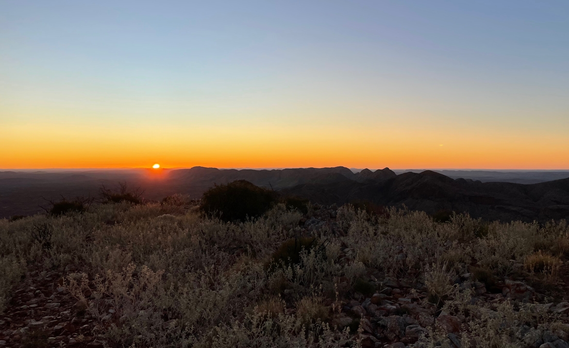
Sunrise at Brinkley.
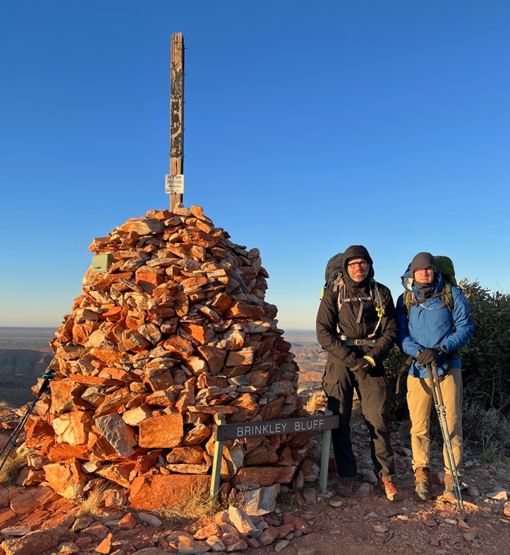
Fraser & Phil looking appropriately frigid at the Brinkley Bluff cairn.
Heading west from the rock cairn at Brinkley's Bluff you basically fall straight off the southern face of the ridge. A series of tight switch-backs drop you down the mountain to a saddle some 190m below. After the rapid 20min descent you look back up and can't help pitying hikers going West to East. It's a wicked climb.
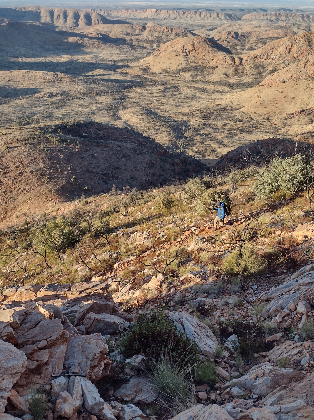
Phil carefully negotiating the switchbacks.
Views, as with most high points along the trail, were stunning. When you are consumed with immediate trail problems (like the placement of your next footstep) it can easy to forget to appreciate the harsh wild beauty of the place.
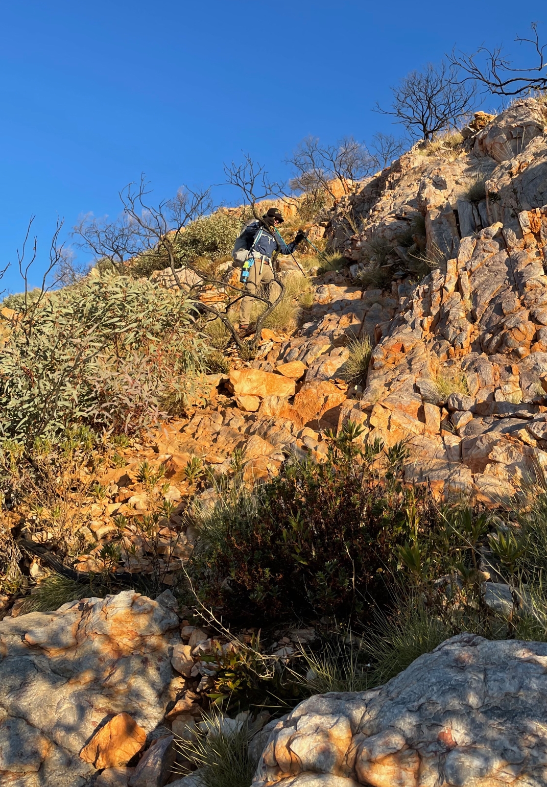
Descending from Brinkley.
I was last over the edge but ended up being first to the bottom. The others all paused part way down to shed their warm gear. I had again started 'cold' so found myself alone at the base of the switch backs. Any time I paused for more than a few minutes the pack would come off.
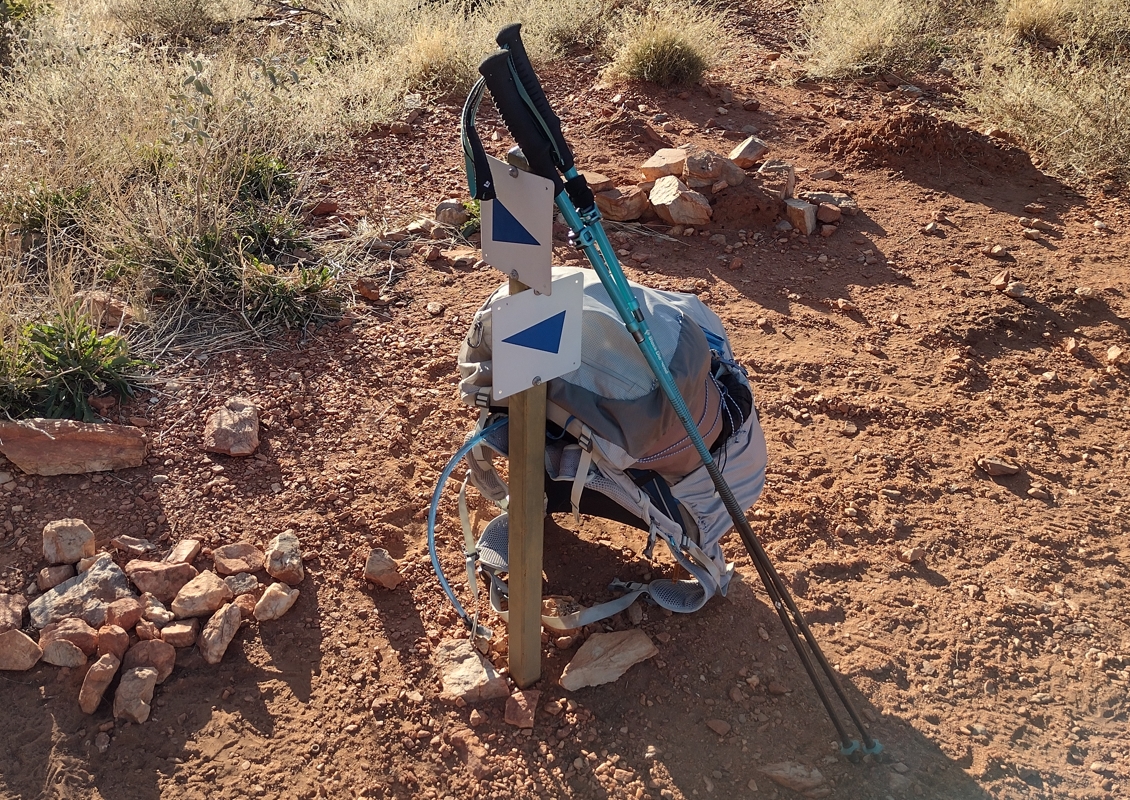
My pack and poles.
I had chosen an Osprey Levity (60L) pack. Limited in some ways, it's one standout feature for me was it's weight. Durability, flexibility, versatility, and comfort are all perhaps questionable. I needed every edge I could get on this trail. The 500-1500gm (1.1-3.3lb) of weight savings relative to more standard packs was gold.
Likewise my sticks. Black Diamond Women's Distance Carbon FLZ Z-folds. At 340gm (12oz) they are about the lightest on the market. I am a big fan. Essential in any terrain where the footing is uncertain. A big help in uphill climbs. I would normally start a section with them folded and stowed. They would then become a kind of of "technological boost" as soon as the going got tough. Whether their impact was real or imaginary I am not sure. Either way I was glad to have them. Breaking or losing them along the trail would have been a serious blow. On the Larapinta I'd estimate they were in use 80-90% of the time.

The view back up towards Brinkley Bluff. My companions descending carefully.
From here the trail heads west. First down to the "hole in the wall" Rocky Cleft for views over the southern plain, and then back up to a saddle.
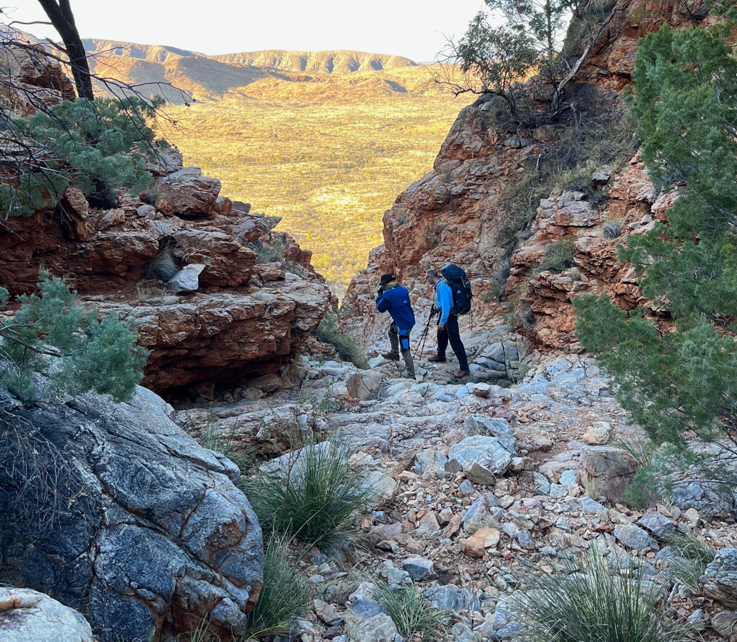
Fraser and I peering down into the gap at Rocky Cleft.
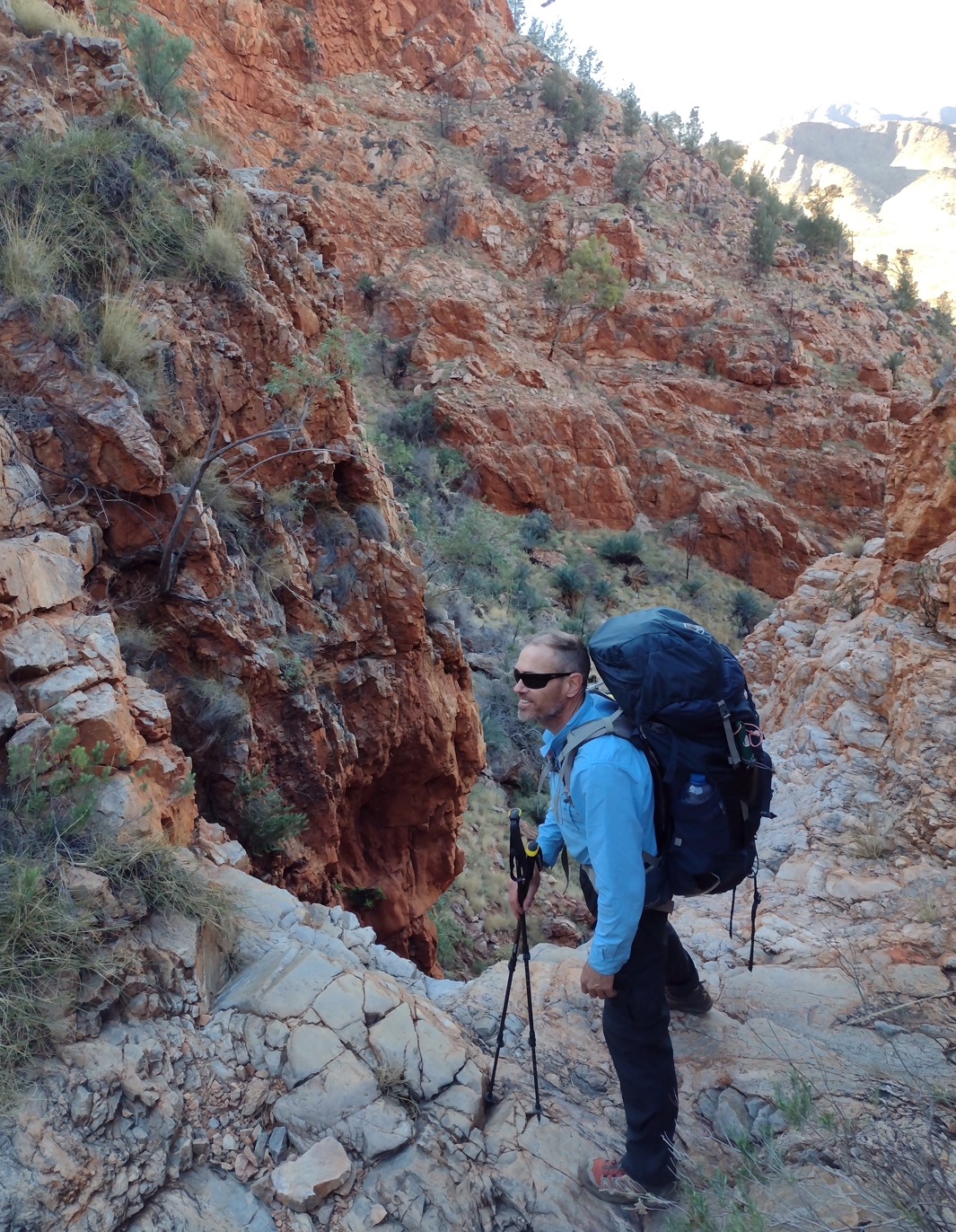
Another angle at Rocky Cleft.
At the saddle we met a 70yr old couple. Hiking in the opposite direction to us they planned to complete the trail in 20 days. Proof that age is no limitation on the Larapinta. They shared some good tips about waterholes further along the trail.
Fraser and I downed packs in the Stuart's Pass creek bed at 9:20am. Elise and Phil were maybe 10min behind. When they arrived we wandered north into Stuart's Pass. A large clean waterhole bordered by ghost gums and sand flats nestled in the wide floor between the gap's rock walls. It was an attractive spot and would have made for a great camp site.
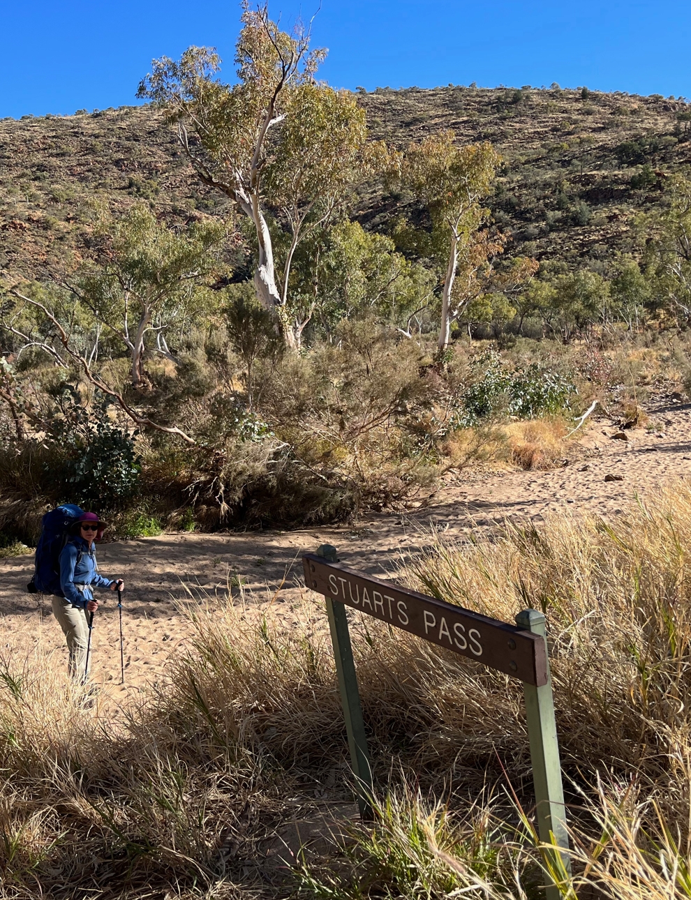
Elise at the Stuart's Pass sign post.
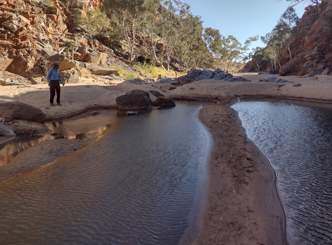
Fraser scouting the attractive sandy waterhole in Stuart's Pass.
From here it is a pleasant flat walk (~1hr) to the Birthday Waterhole Trail Head. We arrived there at 10:40 and re-stocked water. After enjoying an early lunch were walking again slightly after 11:30am.
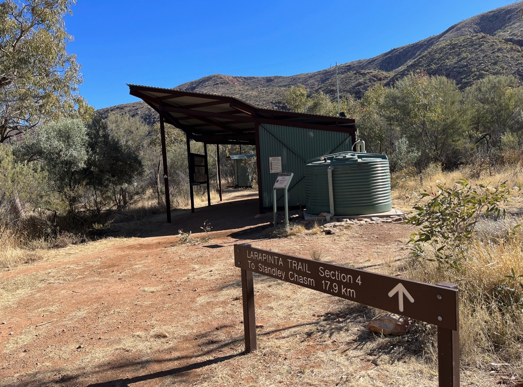
The 4/5 junction (Birthday Waterhole Trail Head)
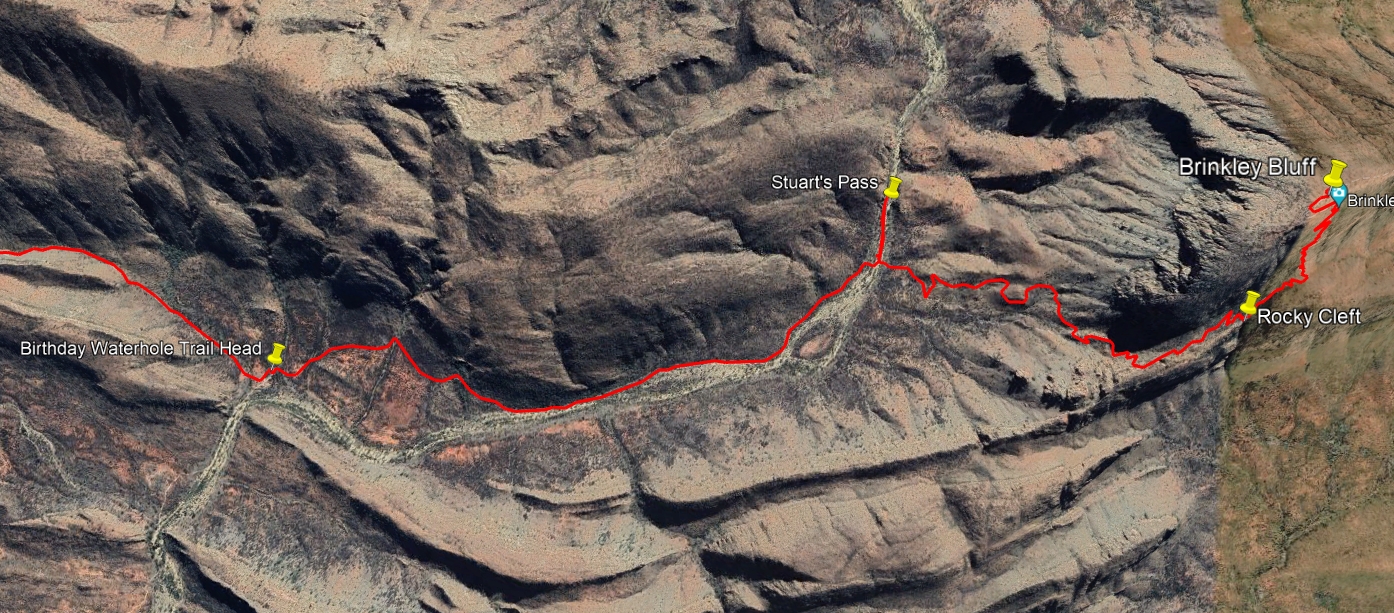
Brinkley to Birthday Waterhole.
For two kilometers we hiked roughly north west. The trail slopes upwards and we gained about 100m in elevation before summitting a saddle overlooking the southern entrance to Spencer Gorge. Five minutes later we had grudgingly forfeited 50m of altitude and proceeded to turn north into the gorge.
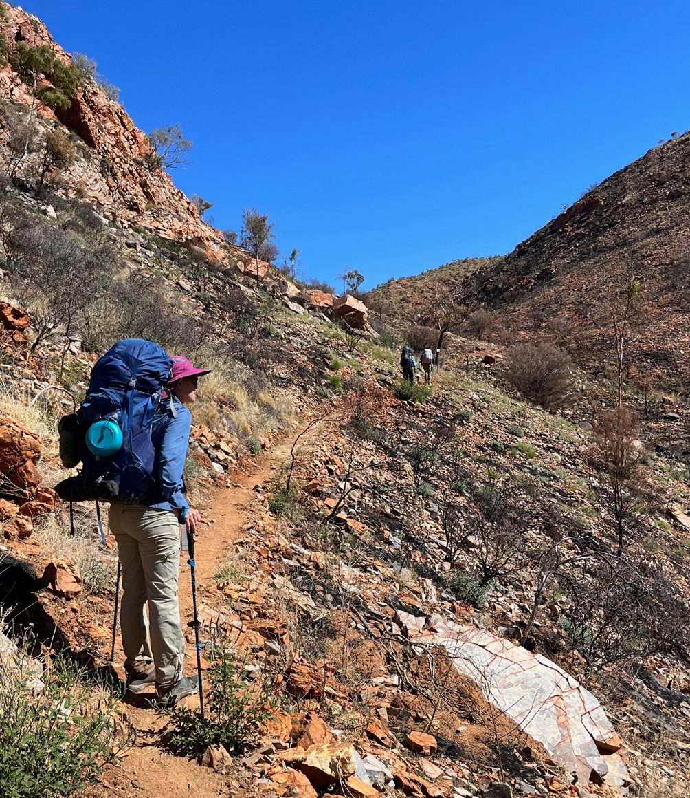
Climbing up to the saddle that precedes Spencer Gorge. Country bearing the marks of a recent (?) fire.
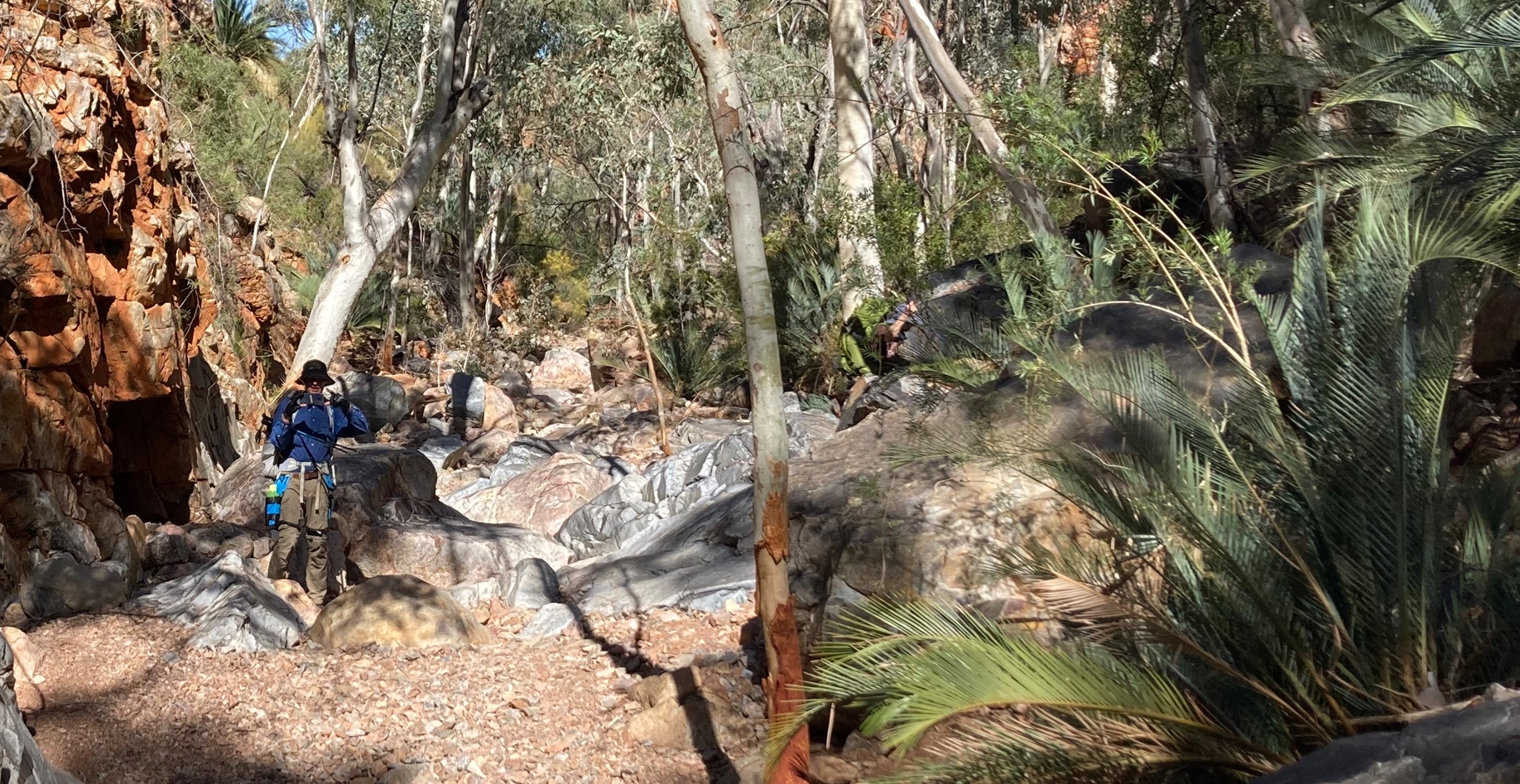
Phil and I in the trees and fronds of Spencer.
Spencer Gorge is memorable. The north-south section up to Rocky Talus is 1.5km in length and rises about 120m. It is strewn with boulders of all sizes. There is no defined track so it is an exercise in rock-hoping and circuitous orienteering around, through, and over obstacles. Deep between steep rocky walls it was partially shaded and reasonably cool. The many large gums and ferns were a welcome visual break from the harsher burnt down scrub we had just come through. It took nearly an hour to navigate this giant natural stairmaster.
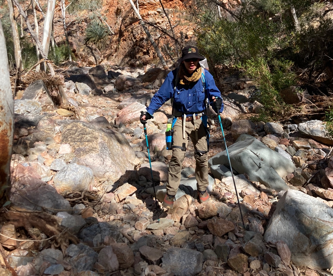
Careful attention being paid. Nobody wants to do an ankle.
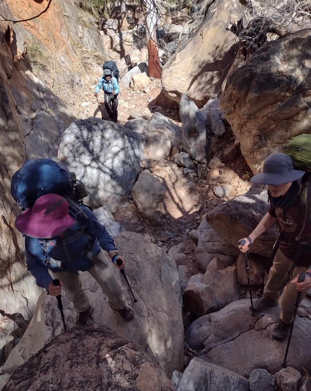
Negotiating some of the larger boulders
At the north end of Spencer is a landmark called Rocky Talus, a rocky scree slope. From there you turn due west and enter a dry and exposed valley that climbs rapidly to Windy Saddle. Beyond is yet another steep climb to Paisley Bluff (and the start of Razorback Ridge). It is 1.4km of exhaustingly hard grind. The vertical climb is about 200m and our ascent took us 40 minutes. I don't remember anything pleasant about it other than putting it behind us. We rested perhaps 5 minutes at Windy Saddle enjoying the breeze on our sweat soaked backs. Finally, slightly after 2pm, we gratefully plonked our packs down at the eastern edge of Razorback. Craving rest we click-clacked our chairs out, carefully seeking the small amounts of available shade.
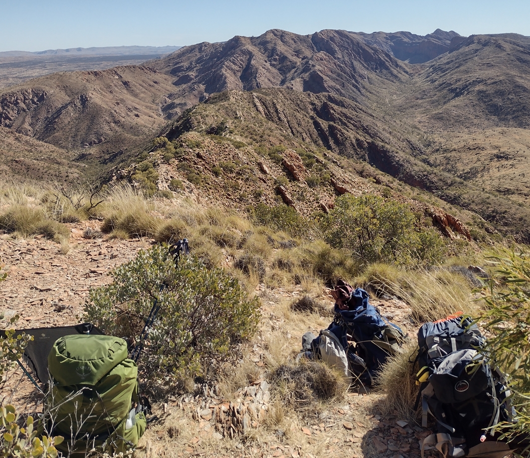
Packs strewn at the western end of Razorback Ridge. The long valley in the top right of the photo is Linear Valley. We would make camp at its far end that night.
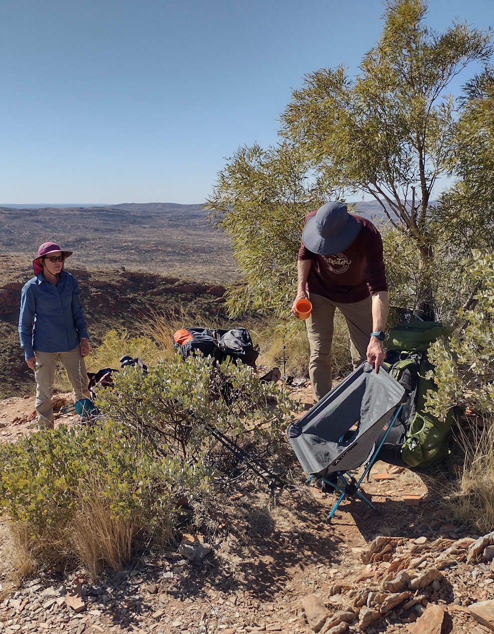
Phil trying to find some shade for his Helinox.
While we rested a lone hiker struggled up off the ridge to our front.
"Howzitgoin'?" asked Phil.
"I'm absolutely stuffed" came the reply.
It checked out. He looked knackered.
He had one strapped up arm. Phil asked if it was a trail injury. Apparently not, rather the result of an old boating/skiing accident. It was clearly non-operable. After a few breaths he stumbled on, back the way we had just come. I thought about what he was just about to descend through and winced. It was hard enough to do with four good limbs. I tucked away a little mental record of that fellow, ready to be retrieved any time I felt like the trail was getting the better of me.
By 3pm we felt sufficiently rested to push on. I had been looking forward to Razorback Ridge. It is a name that conjures up images of a knife edge ridge line with excitingly precipitous drop-aways on both sides. The reality was a little less dramatic.
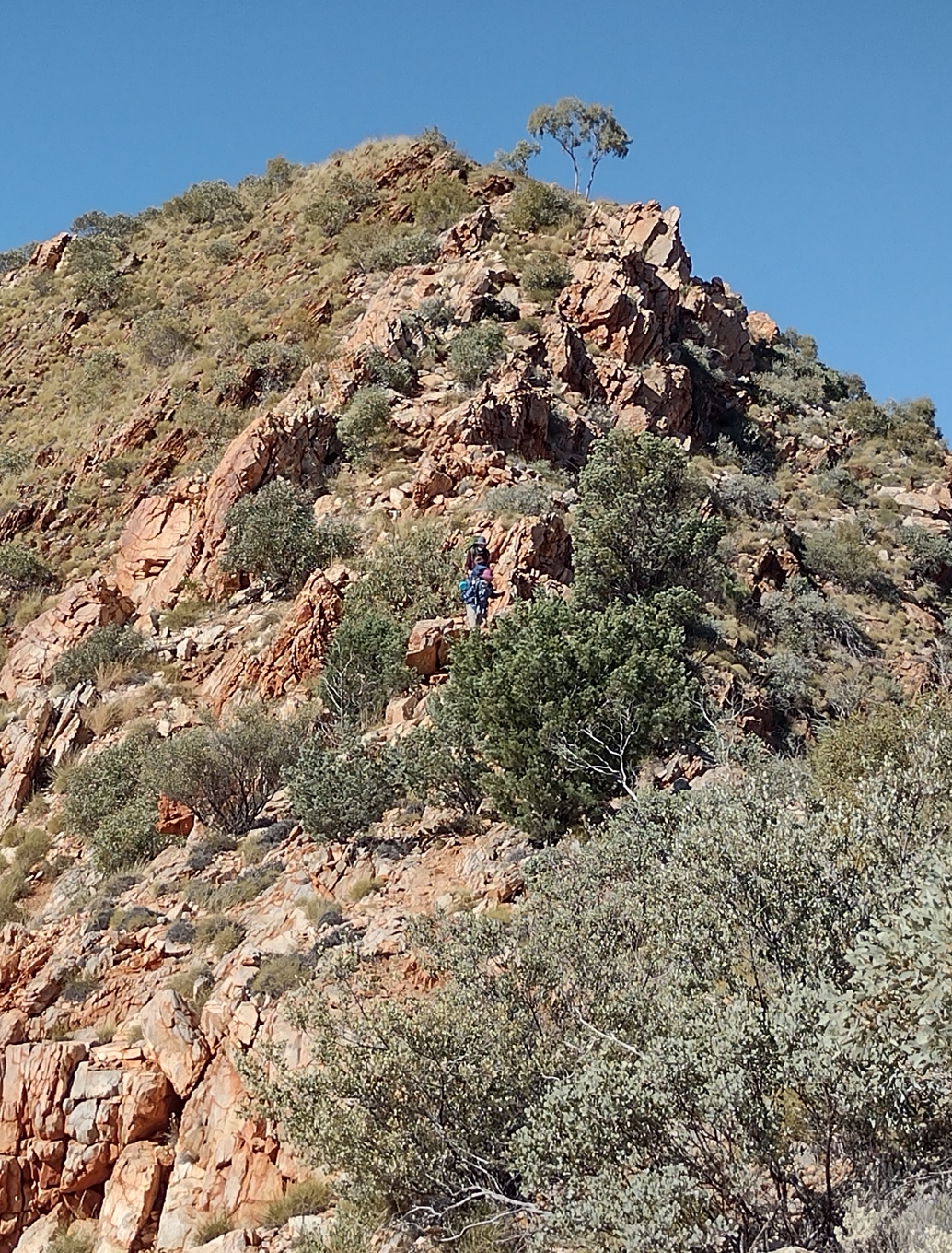
Elise and Phil coming down from Paisley Bluff on to Razorback Ridge.
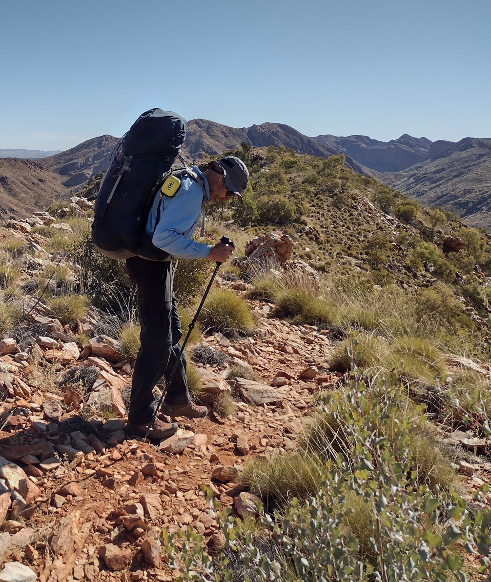
Fraser traversing Razorback.
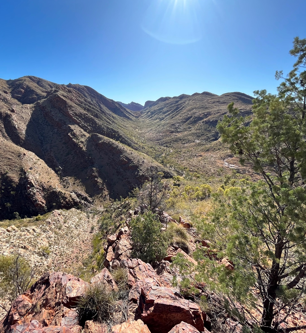
The view from the western end of Razorback. Directly below is the Fringe Lilly camp site. To the right receding away to a saddle in the distance (Rocky Saddle) is Linear Valley.
In 40 minutes we had travelled the length of the ridge and descended to Fringe Lilly Gap (arrived 3:40pm).
Fringe Lilly is a pleasant spot with a wide sandy creek bed. There were a few tents scattered about, but not much activity. We downed packs and trekked a few hundred meters to the south to where we had been told there was some nice waterholes. They didn't disappoint.
It's not always clear on the Larapinta where you can swim and where you can't. Some places are clearly marked as off limits. Most are not. It's also not clear as to what the criteria for allowing or disallowing bathing might be. Is it a hygiene thing? Or an indigenous cultural thing? Dunno.
Anyway. This was a non marked area, so I can't say any of us swam there. What I can say is that if any of us had swam it would have been bone chillingly cold and it would have been an exceedingly quick and breath stealing dip. It's paradoxical that in the blazing environment of the West MacDonnell Ranges the waterholes nestled in its nooks and crannies are utterly glacial.
By the time we returned to our packs at the north end of Fringe Lilly it was after 4pm.
Phil's original plan called for us to continue on to Hugh Junction before making camp. After the day's exertions the thought of another 3.5 to 4km was not appealing. We were all dog tired and no-one felt like yet another uphill hike. We considered calling it a day. But not for long. If you are on this trail at all you probably have a certain pig-headedness in your nature. Five days into this walk we weren't about to let our schedule slip.
We took stock and redistributed some of Elise's load in Fraser's, Phil's, and my packs. Selfishly, we wanted her to be in good shape when we arrived at camp. None of us blokes wanted the responsibility of organizing the evening meal...
At 4:15pm we began the long hike up Linear Valley. Sloping gently at first it gets steeper and finally ramps to pop you out on top of a saddle ("Rocky Saddle", the naming on the Larapinta is often quite literal) 130m higher than the starting point at Fringe Lilly. Mindful of the advancing day we pushed hard and made good time. By 5pm were were heading downhill towards Hugh Gorge Junction. A good thing too. I was running on fumes. In the next 1.5km we shed 120m in elevation and finally staggered into the creek bed that is Hugh Junction at 5:30pm.
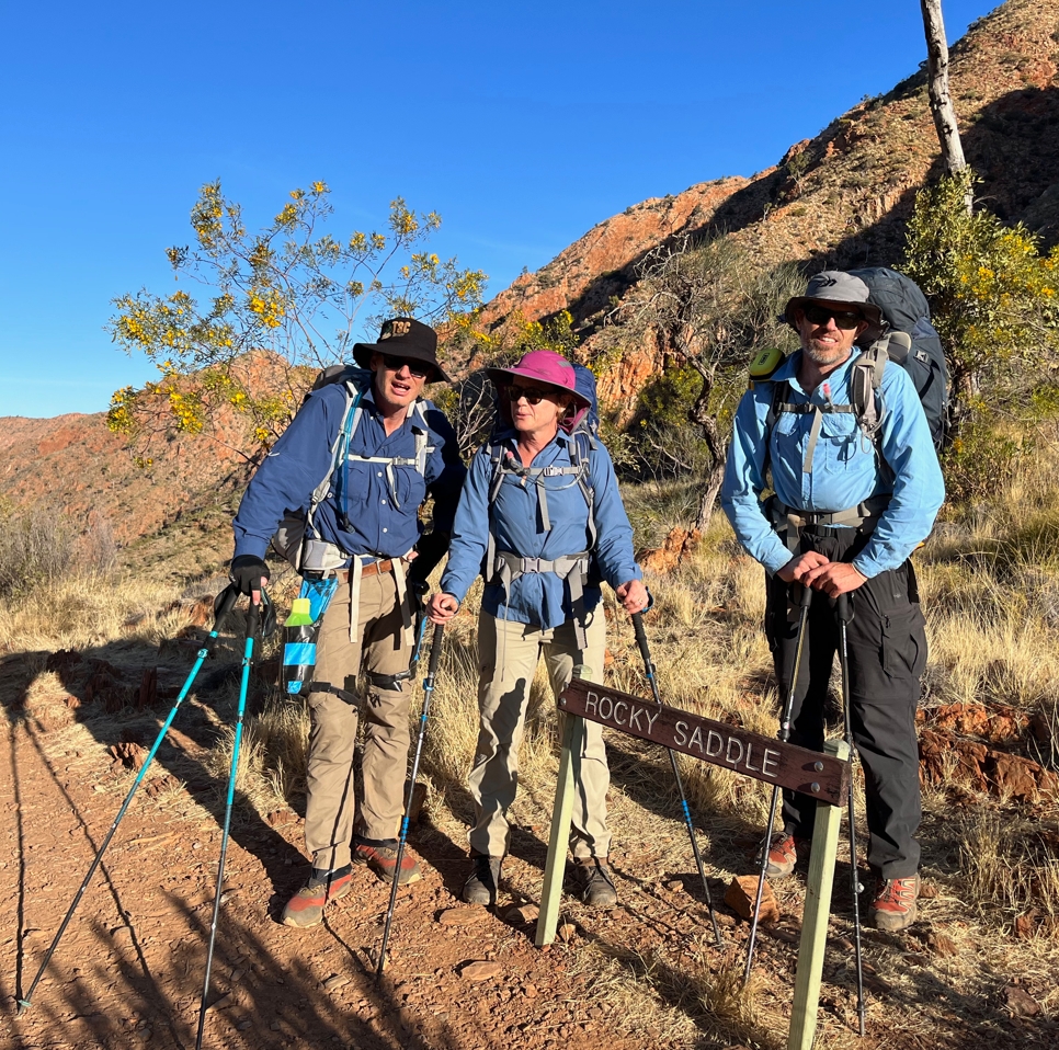
At Rocky Saddle. Fraser looks alright. Elise and I look like we feel. Buggered.
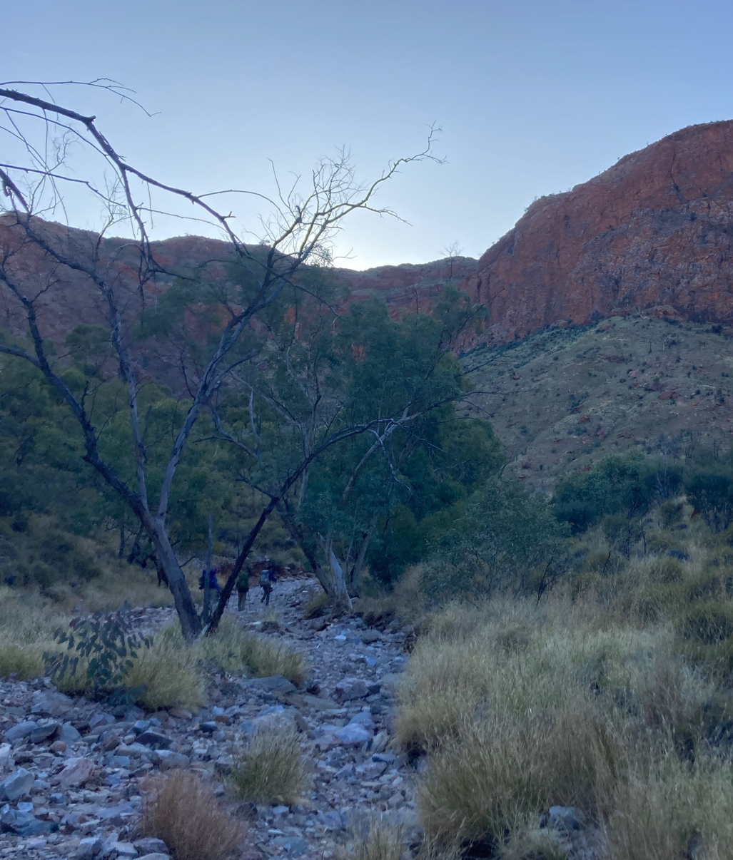
Almost at Hugh Junction. Welcome shadows creep over us as the sun sinks beneath the western gorge ramparts.
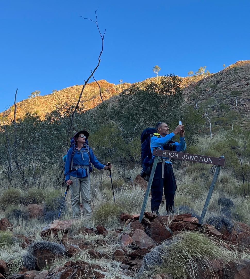
The last of the light on the red gorge walls was pretty spectacular. Fraser was keen to capture it.
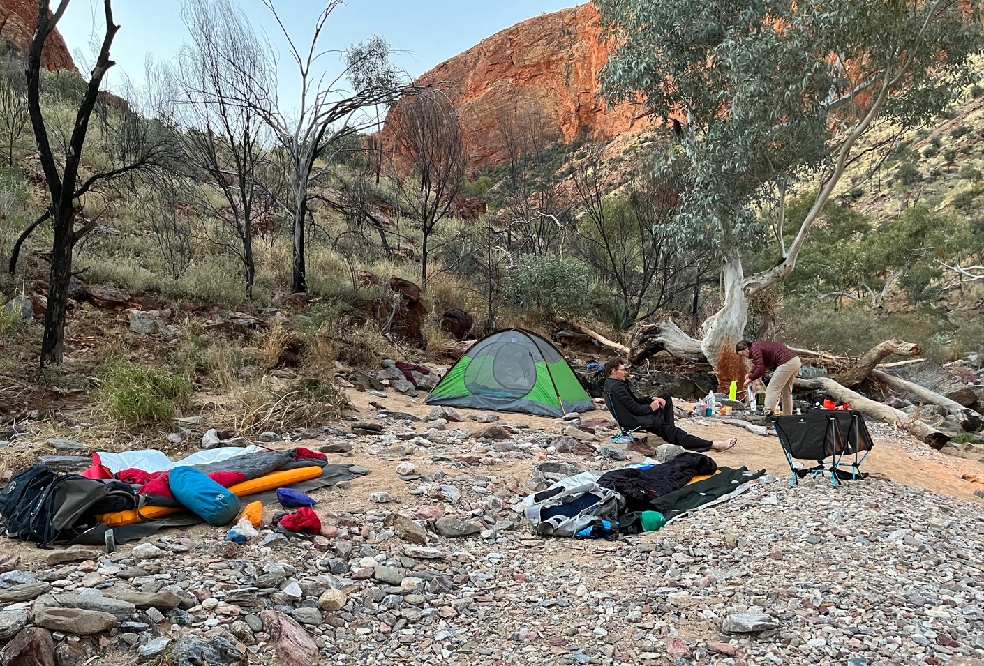
Our camp at Hugh Junction. I am sacked out on my chair doing nothing, while Elise busily organizes dinner. Never would have seen that coming.
Trekking along the spine of Razorback earlier I had noticed a twinge in my right shin. It had gotten progressively worse as the afternoon wore on and by the time we reached Hugh Junction the pain was real. Sitting in my camp chair I arched my foot upwards and winced. Time to dive into the deep end of the inky-black negativity pool. Even with all the training I had done, I had not replicated the back-to-back-to-back strenuous full-day hikes we were now doing. Had I pushed it too hard today and done myself a serious injury? Should I have completed a week long hike as part of my training? Bad enough that this might be the end of my Larapinta adventure, I also knew it might ruin the hike for my companions as well. Strangely, the thought that this could be trail ending steeled me a bit. Fuck it, pain be damned, I wasn't going to bail on this hike without demonstrable cause.
With her long history of hockey injuries Elise proffered some advice about shin splints, and Phil offered up some strapping tape. I declined, saying I would see how it felt in the morning. Another Voltaren from Elise was gratefully accepted though. I turned in for the night hoping that the rest and the anti-inflammatory would work some unexpected magic.
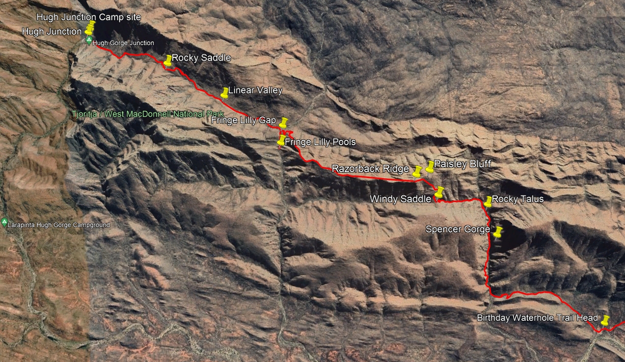
The track from Birthday Waterhole to Hugh Junction
- Prologue
- Day 1: Alice Springs to Wallaby Gap
- Day 2: Wallaby Gap to Bond Gap
- Day 3: Bond Gap to Loretta's Lookout
- Day 4: Loretta's Lookout to Brinkley Bluff
- Day 5: Brinkley Bluff to Hugh Junction
- Day 6: Hugh Junction to Rocky Gully
- Day 7: Rocky Gully to Serpentine Gorge
- Day 8: Serpentine Gorge to Serpentine Chalet Dam
- Day 9: Serpentine Chalet Dam to Ormiston Gorge
- Day 10: Ormiston Gorge to Finke River
- Day 11: Finke River to Rocky Bar Gap
- Day 12: Rocky Bar Gap to Redbank Gorge
- Day 13: Mt Sonder, and back to Alice Springs
- Epilogue