The Dark Emu Mounds
On page 25 of Bruce Pascoe's "Dark Emu" (2018 Edition) I came across the following paragraph.
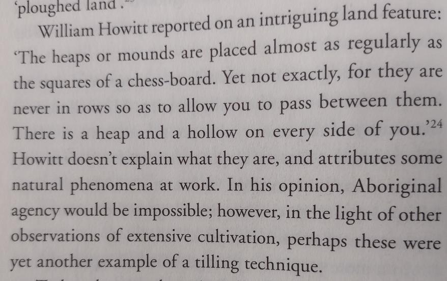
William Howitt reported on an intriguing land feature: 'The heaps or mounds are placed almost as regularly as the squares of a chess-board. Yet not exactly, for they are never in rows so as to allow you to pass between them. There is a heap and a hollow on every side of you.' Howitt doesn't explain what they are, and attributes some natural phenomena at work. In his opinion, Aboriginal agency would be impossible; however, in the light of other observations of extensive cultivation, perhaps these were yet another example of a tilling technique. (emphasis added)
As is his way, Pascoe takes a random historical observation and interprets it to best suit his cause. No effort is made to explore alternate (and more plausible) explanations.
Yes, perhaps the "heaps or mounds" were an "example of a tilling technique".
Or perhaps they were something else entirely (?!!) 1.
Back in my grad student days I was a card carrying member of the SSSA2. Getting a yearly junket to the highly exciting national conference3 was one of the benefits.
The study I did then, and the work I have done since, means I am well versed in various matters relating to soil science.
One of these things is gilgai. The word "gilgai" is worth celebrating purely for the oddball fact4 that it is an Aboriginal (Kamilaroi) word better known amongst international soil scientists than amongst actual regular Australians .
It is the accepted name of a particular type of soil microrelief. A type that is quite well characterized by William Howitt's phrase "There is a heap and a hollow on every side of you."
This description, along with some of the other hints in the paragraph (regular placement, never in rows etc) point strongly to the presence of gilgai of one form or another.
If I'm correct, these "heaps or mounds" are definitely not "an example of a tilling technique".
Unlike Bruce, however, I prefer to have my beliefs backed by something stronger than evidence-free speculation.
So I went to the source 5 referenced by Pascoe. In it I found the following excerpt.
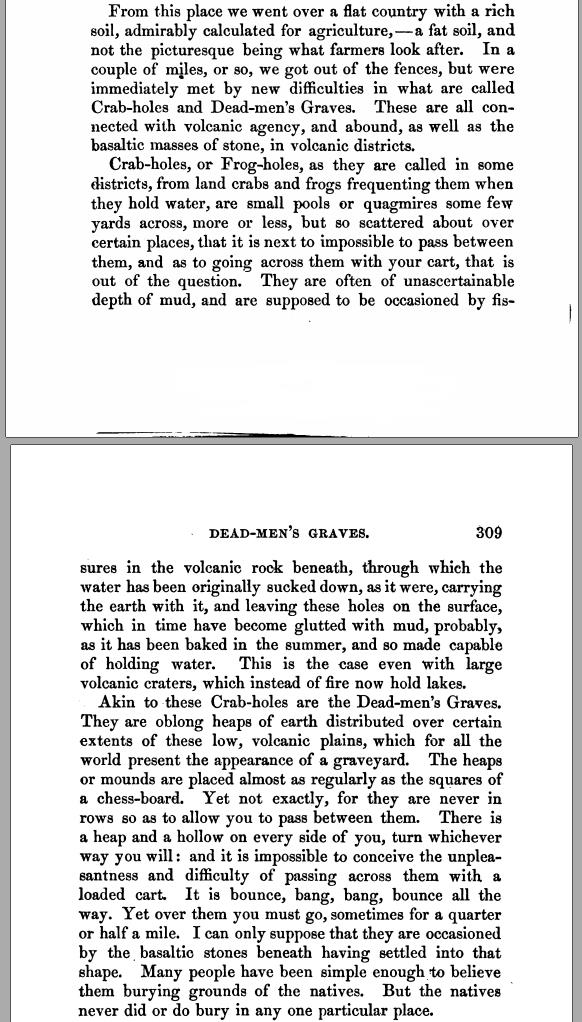
The source is essentially a journal from the early 1850s (only ~15 years after first settlement in this area 6). In the relevant section Howitt describes his travel from Melbourne to the gold fields at Bendigo.
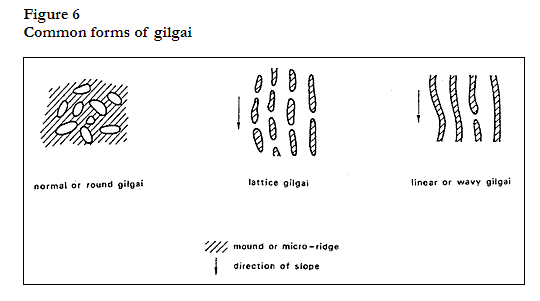
Howitt describes two different land features. "Crab-holes" and "Dead-men's Graves". "Crabholes" is still a regionally popular name 7 for certain gilgai. "Dead-men's Graves" is new to me. The description "oblong heaps of earth ... placed regularly ... squares of a chess-board ... yet not exactly ... never in rows" is highly interpretable. There is a definite ambiguity in the description whereby he equates the layout to be like a chess-board (i.e., in rows), but then explicitly says they are never in rows. It certainly could be gilgai, as this phenomenon comes in many different forms. For instance, lattice gilgai has a kind of "cemetery-like" appearance 8.
Having spent a fair amount of time peering at gilgai infested fields in Google Earth (don't ask) I am quite adept at identifying their presence from satellite imagery. I wondered if I could trace Howitt's moves and see if his location at the time of the above observations matched up with any obvious gilgai formations.
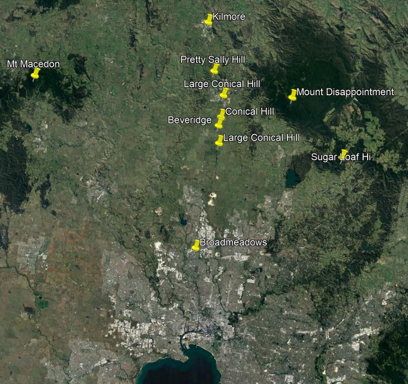
From his daily travel descriptions it is possible to track his progress relative to landmarks he notes along his path.
Below I have marked features mentioned between Broadmeadows and Kilmore. Based on travel direction, the 'heaps or mounds' must occur south of the "conical hill" he climbed ("At the foot of the hill lay Mr. Beveridge's Station") after passing through the "Crab-holes" and "Dead-men's Graves" the prior day. There are three conical hills along Howitt's path, and one town called Beveridge. While it is not clear which conical hill he climbed, searching south of all of them seemed a good starting point.
Much of the land over which Howitt travelled is now covered by the buildings and roads of Melbourne. One of my concerns was that I would find nothing due to the described land features now being under suburbia.
It turned out to not be an issue.
It took no time to find a large band of gilgai microrelief stretching in a band across Howitt's path. Not only in the open fields, but also in some of the backyards and open areas within Melbourne's sprawling northern extremities. While it cannot be said with certainty that any of the areas I identified are in the exact path of Howitt, it seems that these "crabholes" are examples of the 'heaps or mounds' Howitt described and they are certainly not of anthropogenic origin.
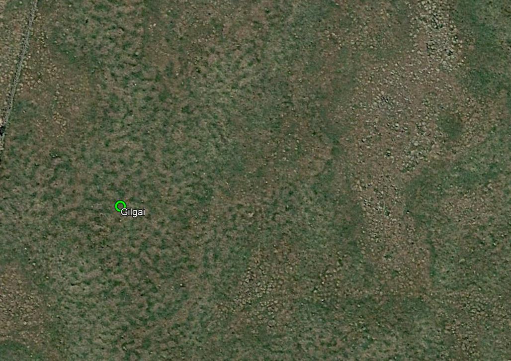
Gilgai detail at 144.98189966 E, 37.547116598 S
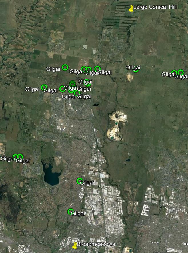
Identified gilgai locations
Fascinatingly, there is a new (opened 2022) primary school right in the search area called "Gilgai Plains Primary School"9. Given that Kamilaroi country is in northern NSW it seems safe to assume that the name 'Gilgai Plains' relates to the local terrain, not from some local Aboriginal place reference.
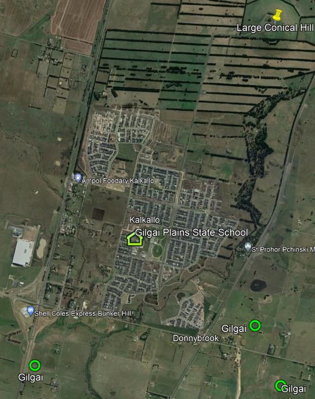
Gilgai Plains Primary School
More problematic is the "Dead-men's Graves". While I suspect this too is a gilgai feature I could not find anything which was:
- definitively gilgai, and
- different from the primary (crabhole) gilgai formations, and
- unambiguously shaped like grave mounds
Some examples of possibilities are below.
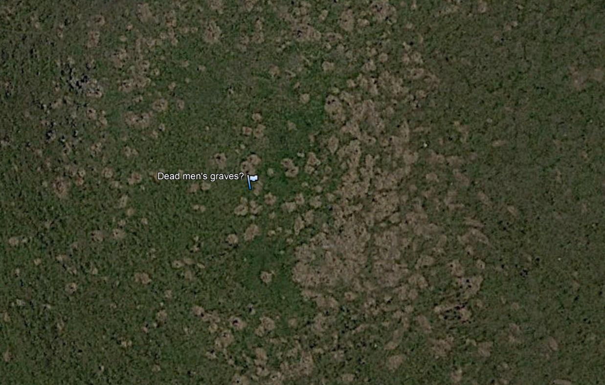
Features at 144.87033245 E, 37.615793403 S
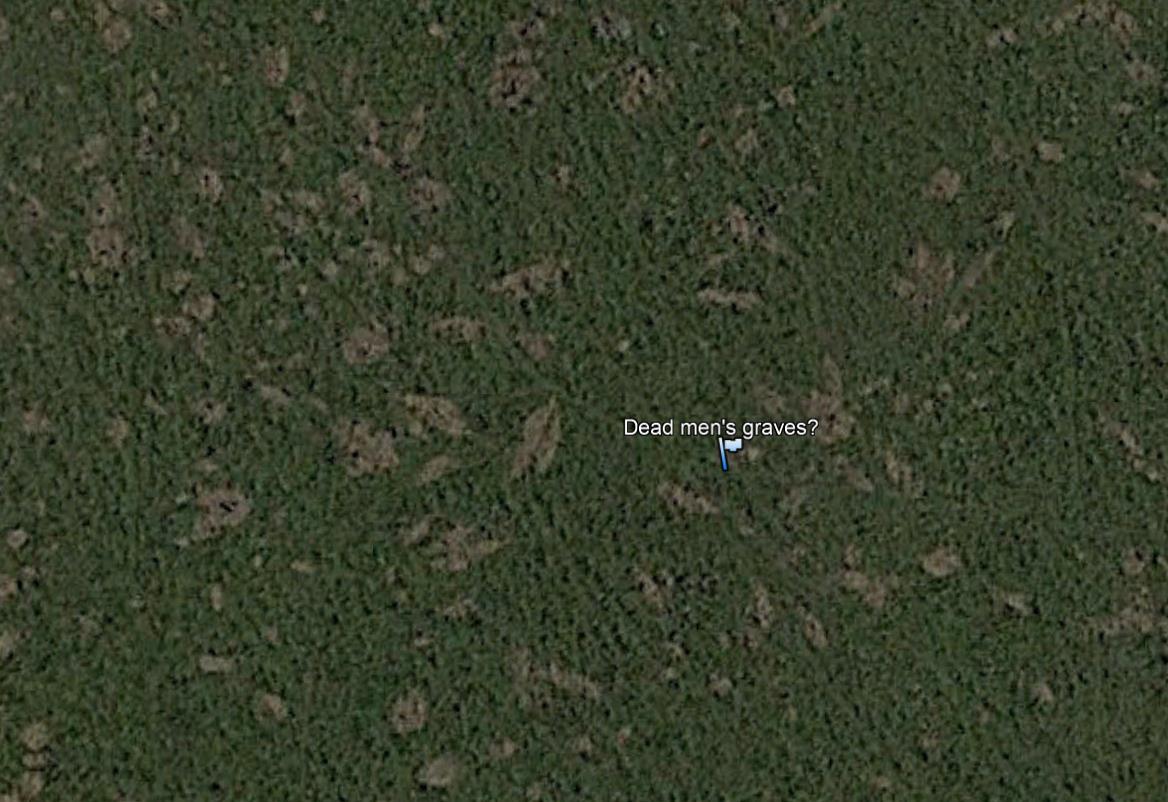
Features at 144.872171978 E, 37.61826237 S
These are a roughly correct fit for the description, but I cannot speculate as to their genesis, or even if they are rock or soil.
So what have I established? Basically, Howitt was travelling through country known to contain soil types exhibiting gilgai microrelief. Gilgai are not some sort of ephemeral feature, if they are there now they would have been there in 1850. These features are naturally occurring phenomena, not man made (although, interestingly, their genesis is poorly understood8). Howitt's recorded observations (and the name 'Crab-holes') are entirely consistent with what we would have expected him to see.
The one sticking point is his differentiation between "Crab-holes" and "Dead-men's Graves". If I can not positively identify these "Dead-men's Graves", I am unable to 100% rule out some feature of Aboriginal origin was present. Do I consider this likely? No. Particularly given the known proclivities of the soil types present, and Howitt's own contemporaneously recorded understandings of the nature of the mounds. However, it is what it is.
Consequently, I am at a dead end for now. Further illumination will only come with advice from local experts or a site visit myself.
It is frustrating to not be able to provide a fully conclusive rebuttal to Dark Emu's speculation on this issue. However, time is not a problem. Better to wait for further evidence than to commit Pascoe's errors of reckless conjecture.
UPDATE 2024-06-07
I finally had a chance to go over some of the ground discussed above. It was a hurried visit before a mid-morning flight out, but it did not take long to find the expected gilgai microrelief. As you can see from my photos (taken in the dawn mist) the terrain matches well the 'crab hole' descriptions of William Howitt. This brief excursion found no features matching the mounded 'dead man's graves' described. Many fields in the region are strewn with large igneous rocks, and these do show up in aerial imagery, but clearly are not the described soil feature.
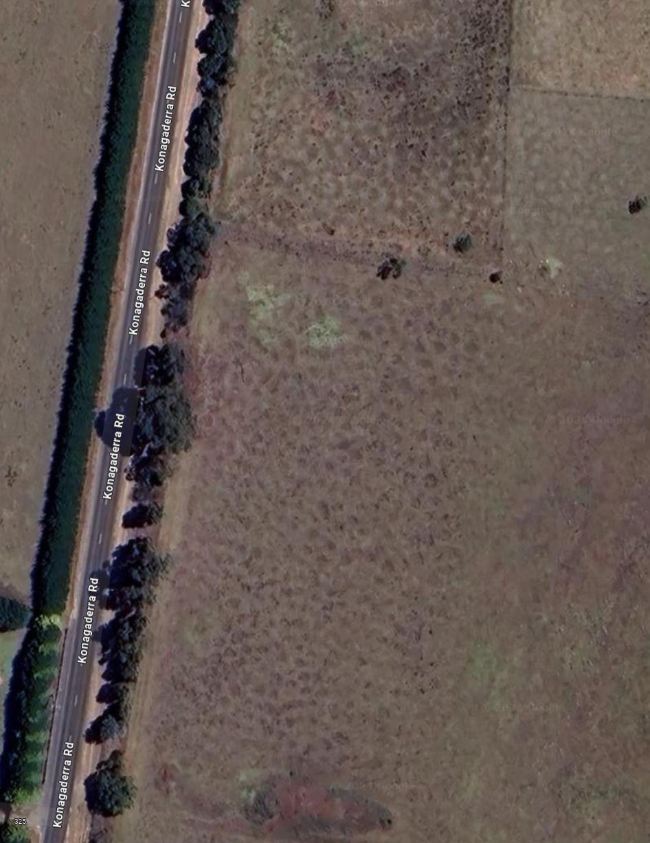
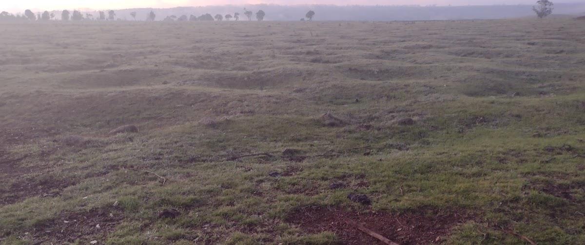
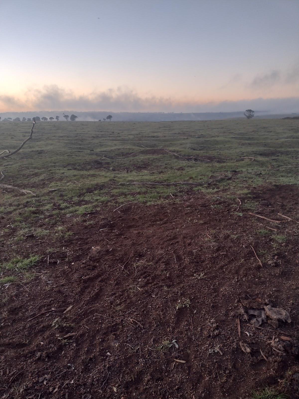
Features at 144.8340424 E, 37.543159 S-
It is fascinating that the conclusions in "Dark Emu" rely so much on (Pascoe's interpretations of) the observations of early Australian colonials, yet (as in this case) he often completely disregards the primary source's explanations. It is abundantly clear that Howitt does not consider the soil features to be related to any form of human activity, tillage or otherwise. Howitt was in the region less than two decades after initial settlement. First hand descriptions of Aboriginal practices in the area would likely have been available to him.↩
-
One of my professors (hi Larry!) summed up the excitement levels available at the National Agronomy Meetings, stating "Agronomists come to these meetings with one pair of underpants and one $20 bill - and change neither."↩
-
Probably, I just made that up, Bruce Pascoe style.↩
-
"Land, Labour, and Gold; Or, Two Years in Victoria: with Visits to Sydney and Van Diemen's Land · Volume 2" by William Howitt.↩
-
1835: The Founding of Melbourne & the Conquest of Australia. By James Boyce↩
-
Pers. comm. Dr Andrew Biggs. Department of Resources, Qld.↩↩
-
Gilgai Plains Primary School. 10 Sequoia Dr Kalkallo 3064.↩